The winter rains have slowed down and sunny skies have returned. It’s time to take a hike!
Enjoying beautiful parks and outdoors are a core piece of living in California. But it can be an overwhelming task to figure out where to go, how long it will take, what suits your fitness level, etc.
Below, we’ve narrowed it down to four choice East Bay hikes, offering something for the adventurous and the not-so-adventurous, too.
- Nimitz Way to Rotary Peace Grove
Berkeley
Distance: Four miles
Trailhead: Inspiration Point in Tilden Regional Park off Wildcat Canyon Rd
The East Bay Regional Parks system boasts some of the most beautiful landscapes in the region. This easy hike is paved, well-marked, and with vistas around every turn. Nimitz Way is busy on weekends with joggers, strollers, dogs, and families, so if you’re seeking peace, go mid-week. Nearing the two mile mark, take Wildcat Peak trail to reach the Rotary Peace Grove Lookout where you can take in breathtaking views.
- Lake Chabot Loop
Castro Valley
Distance: 3.64 miles or nine miles
Trailhead: Lake Chabot Marina, Lake Chabot Regional Park
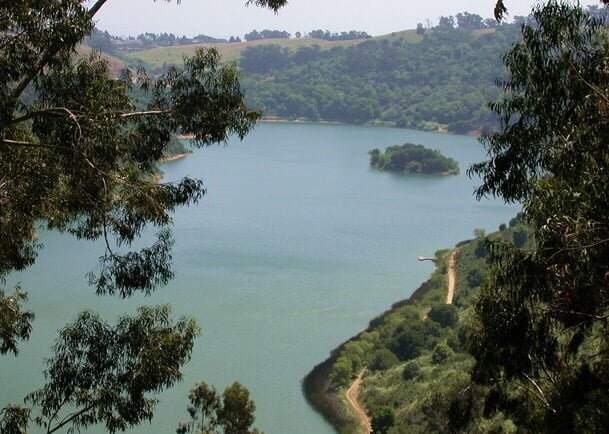
Take the paved West Shore trail (3.64 miles r/t) from the Marina to the dam where you might spy a pair of bald eagles flying across the lake. For a more rigorous hike, continue on from the dam to circle the lake via the West Shore Trail, to Bass Cove Trail, to Columbine Trail, to Honker Bay Trail, to Cameron Loop Trail, to East Shore Trail back to the Marina. The paths aren’t always clearly marked, so be alert.
- East Ridge to West Ridge Loop
Oakland
Distance: ~10 miles
Trailhead: Canyon Meadow Staging Area, Redwood Regional Park
This is a satisfying loop, circling the prize jewel that is the Redwood Regional Park. Start at Canyon Meadow Staging area and take the Canyon Trail for a short hop up to the East Ridge Trail. The unsheltered ridge on the east side provides sweeping views. The Skyline Gate Staging Area is your approximate halfway marker, where you’ll link on to the West Ridge Trail (where you have wide-open views towards Contra Costa) to complete the circuit.
- Wildcat Creek Trail – San Pablo Ridge Trail Loop
Richmond
Distance: Six miles
Trailhead: Alvarado Area, Wildcat Canyon Regional Park
Wildcat Canyon is the perfect place for hikers who live in El Sobrante and El Cerrito. Abutting Tilden’s northern edge, Nimitz Way continues into this park. To take this loop, enter at Alvarado Area and head out on the paved Wildcat Creek Trail. The creek will likely be flowing to the brim as you parallel it until reaching Mezue Trail where you turn left to begin your ascent. This portion is steep at times, but your hard work is rewarded as views of Mount Tam, San Francisco, and the entire East Bay open up. Turn left when you reach San Pablo Ridge Trail, appreciating the views of Mt. Diablo and San Pablo Reservoir. The descent can be steep, but the views are spectacular. Merge left onto Belgum Trail, which will bring you back to Wildcat Creek Trail to complete the loop.